

Wildland fire mapping
Drone fire mapping for incident teams in Hawaiʻi
We are wildland firefighters who map fires from the air. A night infrared flight finds the heat that daylight and smoke hide and turns it into a perimeter, the hotspots inside it, and files an incident GIS specialist can open. We are based in Kona, with the drone ready to go on Hawaiʻi Island, and this is the work we want here.
Where this work was done
The record, in Oregon
Every fire map below was flown in Oregon. It is our founder's work under Rogue Reconnaissance, our sister company on the mainland, and it is here so you can see what the products look like before you ask for them. None of it is a Hawaiʻi fire.
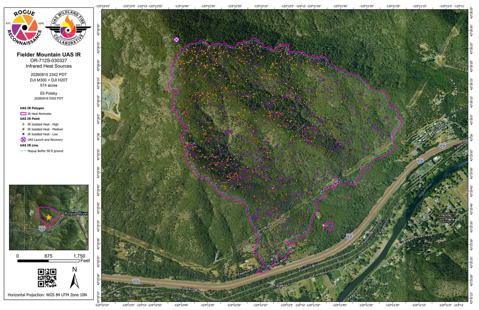
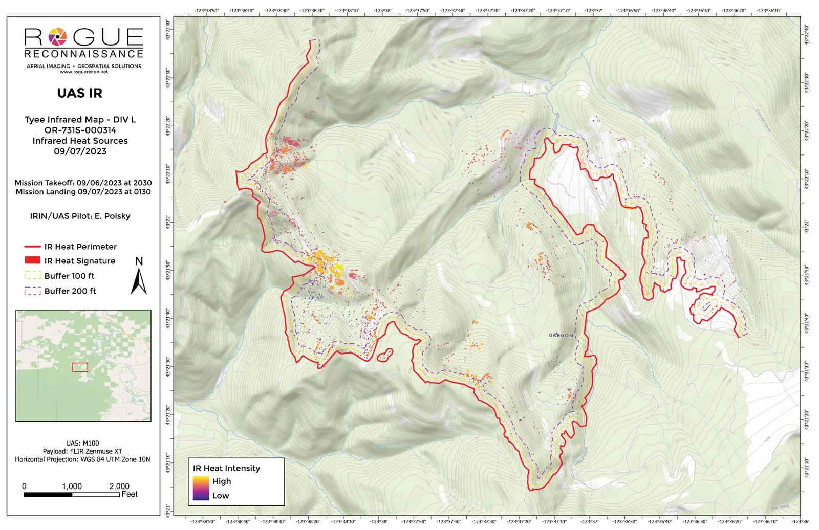
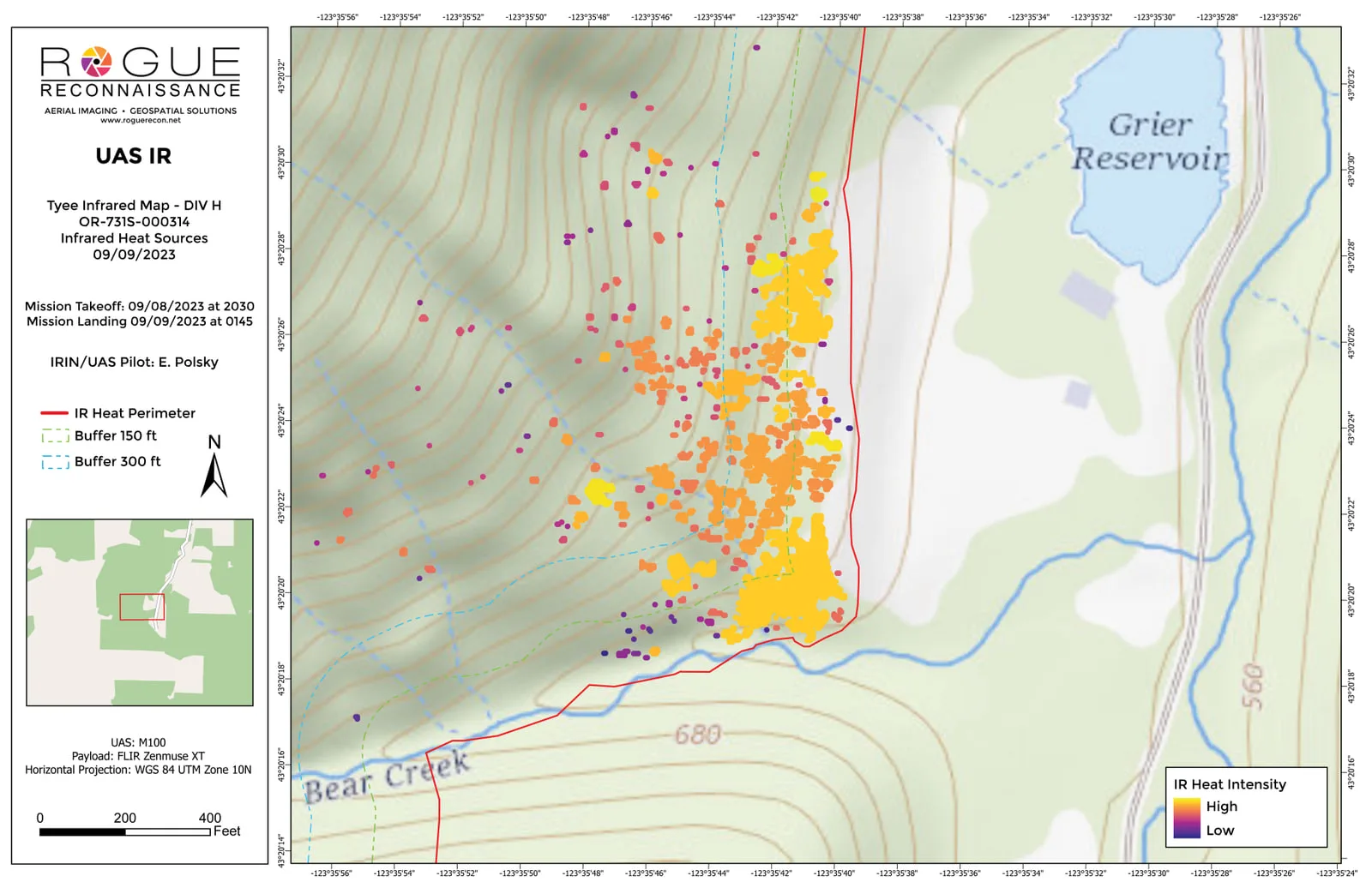
Rogue Reconnaissance keeps the fire by fire record of that work on its own wildland fire page. The 2026 sheet above was built on the template that came out of the UAS Wildland Fire Collaborative, our founder's nonprofit, which is why its mark sits beside the company's on the sheet.
The work
What a fire mapping flight gives an incident
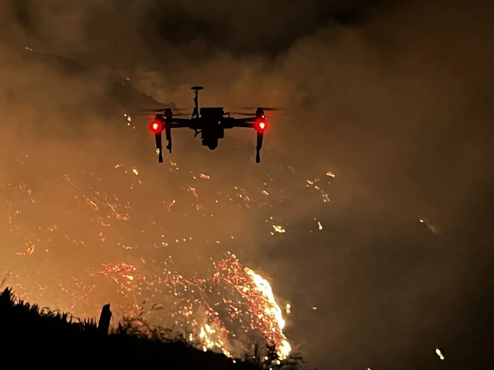
Mapping a wildland fire by drone is a night job. The aircraft grids the fire the way it would grid a parcel, a thermal camera records temperature instead of a picture, and the frames are stitched into one mosaic laid over the ground they cover. Heat is then read out of that mosaic and drawn, so what comes back is not a photograph of a fire. It is a map of where the fire still is.
Flights go up inside the fire's temporary flight restriction, cleared with the incident's air operations, once its crewed aircraft are down for the night, when the airspace is quiet and the ground has let go of the day's warmth. Rock, machinery and bare soil all hold heat into the evening, and a flight in the small hours tells them apart from fire far better than an afternoon one would. It is also the window that gets a map to the morning briefing, before crews walk the line.
What comes off the flight
- A heat perimeter: one line around everything still burning, drawn from measured temperature rather than from where the smoke is
- The heat inside it drawn as an interpreter draws it: intense heat and scattered heat as areas, and isolated heat sources as points graded high, medium or low
- A mopup buffer at the distance operations asks for, so heat lying near the line separates from heat that can wait
- Heat found outside the line, where a spot may be starting, and the launch and recovery point
- Printable map sheets at 11 by 17 inches, one over aerial imagery and one over the contours
- The data under the map: a geodatabase and shapefiles for the GIS specialist, built to the NIFS schema and tagged with the incident's IRWIN ID, a KMZ a crew can open on a phone or a tablet out on the line, and the orthorectified infrared mosaic the heat was read from, as a GeoTIFF
- A flight log for each operational period, recording the aircraft, the times, the ground covered and how the heat was interpreted
Every product in that list comes from fires our founder has mapped on the mainland. The sheets further down this page are those maps.
The people
Who you would be working with
Eli Polsky, who runs Hawaii Mapping, came to this from the fire line rather than from the camera. He holds a red card and three national wildland fire qualifications: FFT1, Firefighter Type 1, the squad boss on the line; GISS, the Geographic Information System Specialist who builds an incident's maps in the situation unit; and UASD, the Unmanned Aircraft Systems Data Specialist, whose job is turning drone data into intelligence an incident can act on. He has been on the Oregon Department of Forestry's Call When Needed list as a drone resource since 2019. His FAA Part 107 certificate dates from November 2016.
He started a nonprofit too, the UAS Wildland Fire Collaborative, and is its Executive Director, so that any drone pilot on any fire has one common way to hand an incident a finished map set. If you fly drones on fires in Hawaiʻi, or you are the person who receives their data, that is worth knowing about.
Here
Bringing it to Hawaiʻi
We work from Kona. The drone, the GIS and the people are already on Hawaiʻi Island and ready to go, and we can reach any other island quickly, the same day or for that night's shift.
Our fire work in Hawaiʻi today is mitigation: drone LiDAR along power lines that mostly run through the top class on the utility's fire risk map, and the tree crews' records of the work that clears them. Incident mapping is the half of it that still sits on the mainland, and we would like to change that.
If you run an incident, a county fire department, or land that burns, we would like to hear what a night infrared flight would be worth to you, and to talk it through before a fire season rather than in the middle of one.
Where to start
Incident teams, counties and land agencies
On an active fire, call 808-298-6290 and have the incident and its IRWIN ID, the GISS the maps go to and the operational period ready. Before a season, tell us the ground you worry about and what your GIS specialist needs to open, and we will walk you through what a night flight over it would produce.
Talk to us about fire mappingLooking for mitigation instead
If the job is keeping a fire from starting, the corridor LiDAR, the tree crew records and the vegetation height data are on the mitigation page.
Wildfire mitigation mapping