
Case study · field data
Vegetation management data for an island wide tree crew program
Big Island Tree Service prunes and removes trees along Hawaiian Electric's power lines all over Hawaiʻi Island. Since December 2023 we have built and run the data side of that work: the forms its crews fill in on iPads, a daily check of what they send, and the dashboards and monthly reports that come out the other end.
What the program looks like
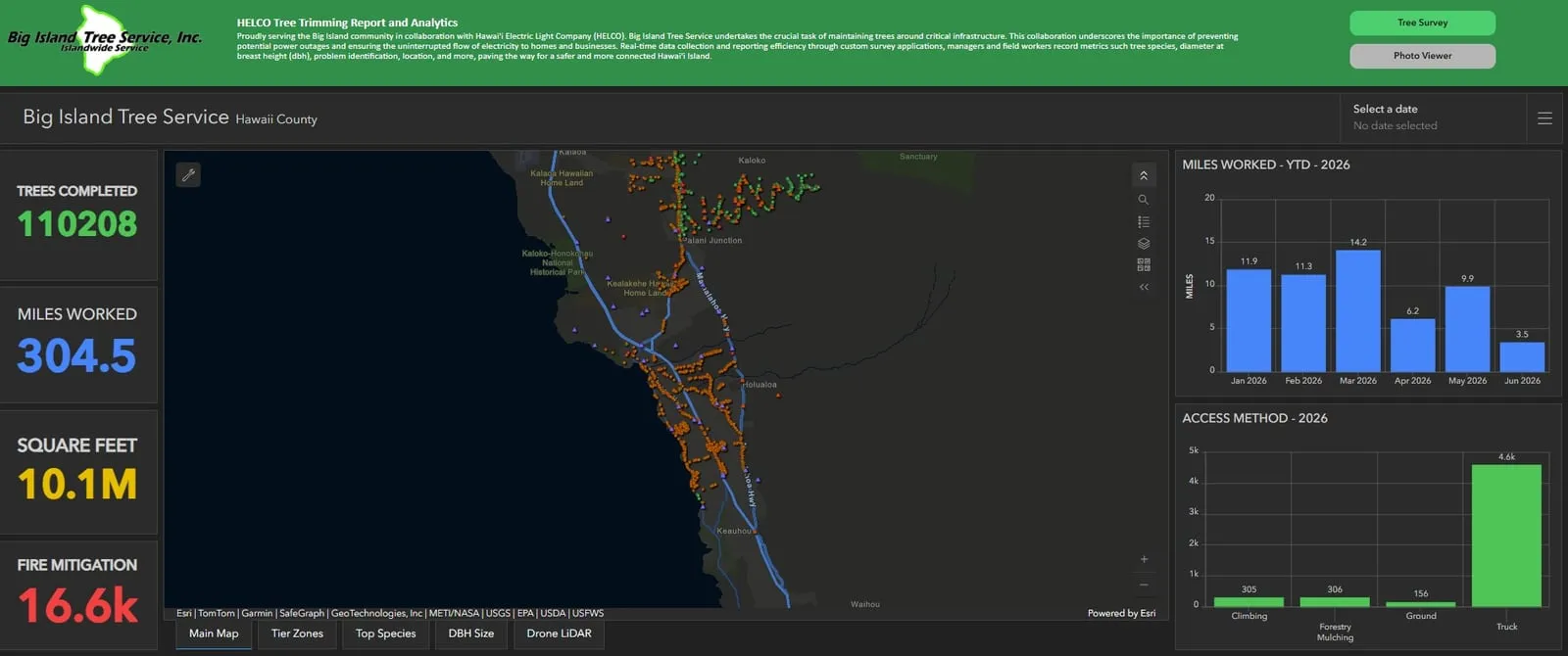
Maps, reports and charts the crews' own entries feed. Select one to read it at full size.
The problem
Every tree a utility crew touches leaves a record behind it: where the tree stands, the circuit it sits under, whether it was pruned or taken down, how the crew got to it, and photos before and after. Across a whole island that record piles up fast. Pieced together by hand at the end of each month, it is slow to turn into a report and hard to keep consistent from one crew to the next. Our 2023 proposal to Big Island Tree Service set out to change how that work gets reported to the utility.
What we built
The crews log their work in Survey123 forms we programmed for tree work, brush clearing and job details, first in use in December 2023. Each tree record says why the crew was sent, whether routine maintenance, a hot spot, a trouble call, fire mitigation or storm work, and whether the line is transmission or distribution. Checks built into the forms keep every crew recording the same details in the same way, and each day we review what comes in: where each tree was logged, the type of work, and the circuit it was assigned to. We host the data, manage the 11 iPads and stay on call for up to 11 crews in the field.
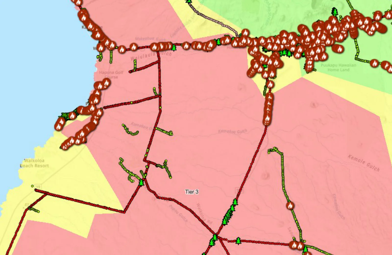
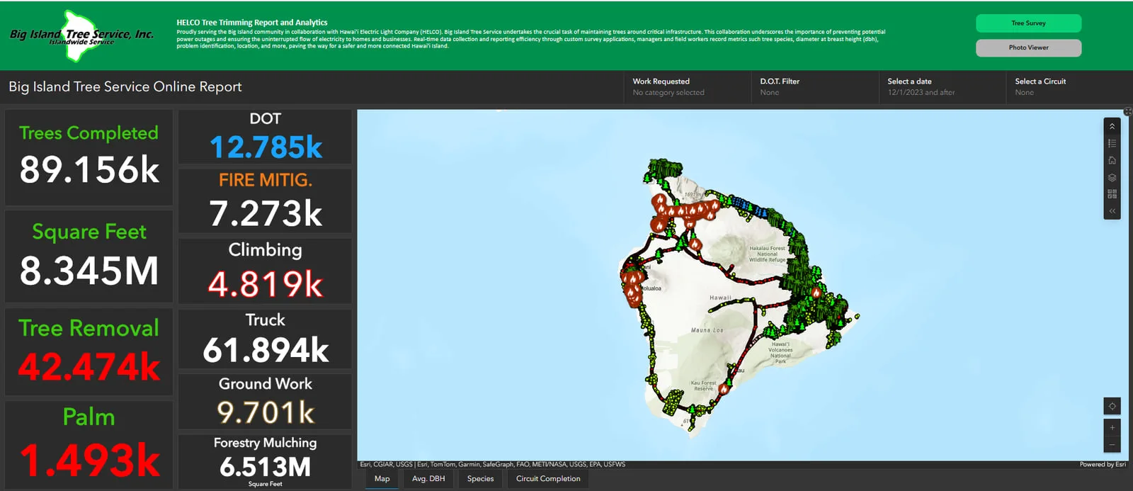
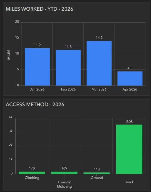
From the forms, the records feed hosted ArcGIS Online layers and live dashboards: work points across the island, miles worked by month, trees by how the crew reached them, circuit completion maps and the fire mitigation work. On the first of every month a report for the utility now builds itself and lands for review before it is passed on, and a year to date version runs on request. The monthly run has fired on schedule six times, April through September 2026, and finished every time.
The program kept growing through 2026: hazard tree reports, proof of completed circuits for audits, tracking of refusals, a photo layer on the dashboard and a tool for timesheet corrections. When Hurricane Lala came through in August 2026, the crews' storm records ran through the same system into a single storm report. See the Hurricane Lala case study →
What the program delivers
- Survey123 forms for trees, brush and job details, with checks built in
- A daily review of tree locations, work types and circuit assignments
- Hosted layers, live dashboards and circuit completion maps
- A monthly report that assembles itself, and year to date reports on request
- iPad management and on call support for up to 11 crews
What it is used for
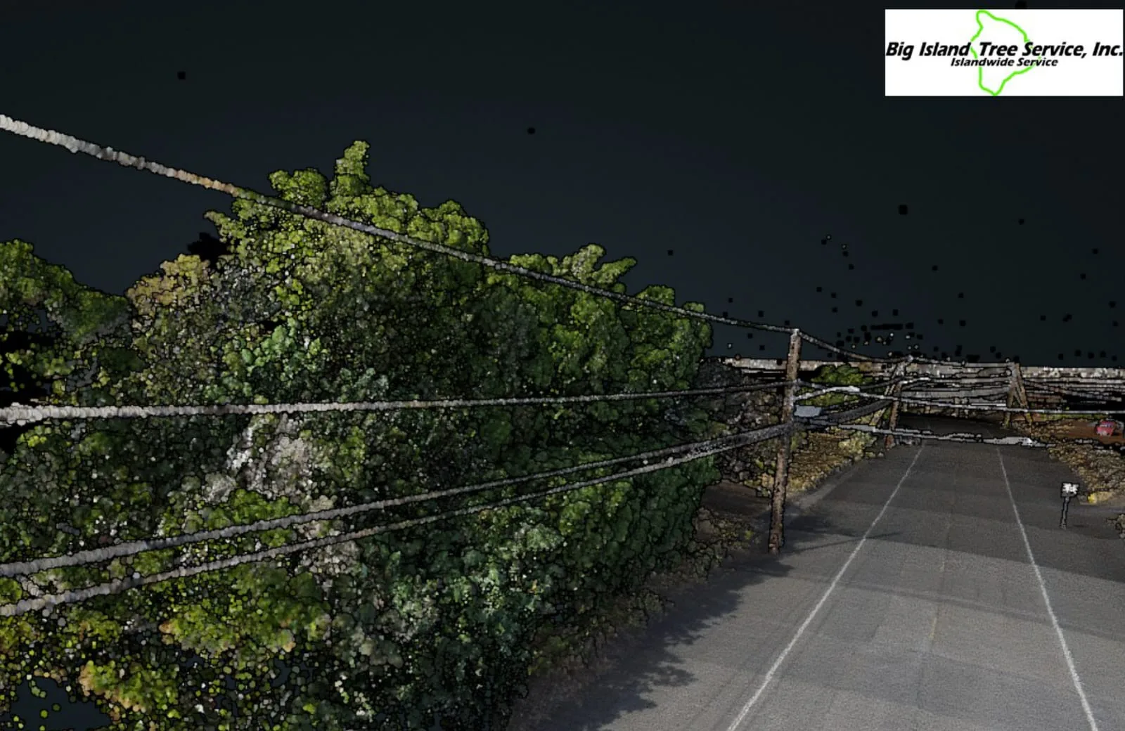
The system is how Big Island Tree Service accounts for its utility vegetation management work on Hawaiian Electric's lines: what was done, where and when. It also credits the work span by span. The program's GIS cuts the island's primary overhead lines, 2,067.4 miles on 140 feeders, into 90,637 sections, so the miles a crew works land on the spans where the work happened. Fire mitigation is logged as its own kind of work and mapped against the utility's fire risk tiers. The drone LiDAR of the power line corridors lives in the same program hub. See the corridor LiDAR case study →
The numbers
- trees worked
- 29,514
- trees pruned
- 16,763
- trees removed
- 12,748
- miles worked
- 104.3
- circuits worked
- 61
- square feet of brush
- 3,713,891
- trees logged as fire mitigation
- 4,814
- of the 104.3 miles in Tier 3, the highest fire risk class
- 24.7
All from the program's year to date workbook, for work dated January 5 to August 31, 2026. Three more trees were logged as wildfire mitigation removals, so pruned and removed come to three short of the total. The dashboards pictured here keep running totals on another basis, so their tiles are not these counts.
Related work and services
Want this for your own crews?
Send how many crews and circuits you run, transmission or distribution, the clearance spec you report against and your reporting dates. We will set up the forms and dashboards, and fly the corridors that need a closer look.