
Case study · storm reporting
Hurricane Lala: the storm response, documented
After Hurricane Lala in August 2026, Big Island Tree Service put its crews on storm work along Hawaiian Electric's lines across Hawaiʻi Island. The crews did the work. We pulled their field records and photos together, reconciled the counts and built the storm report.
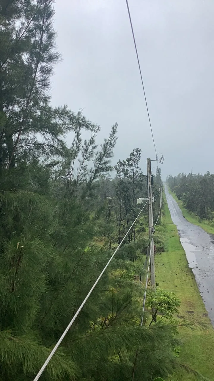
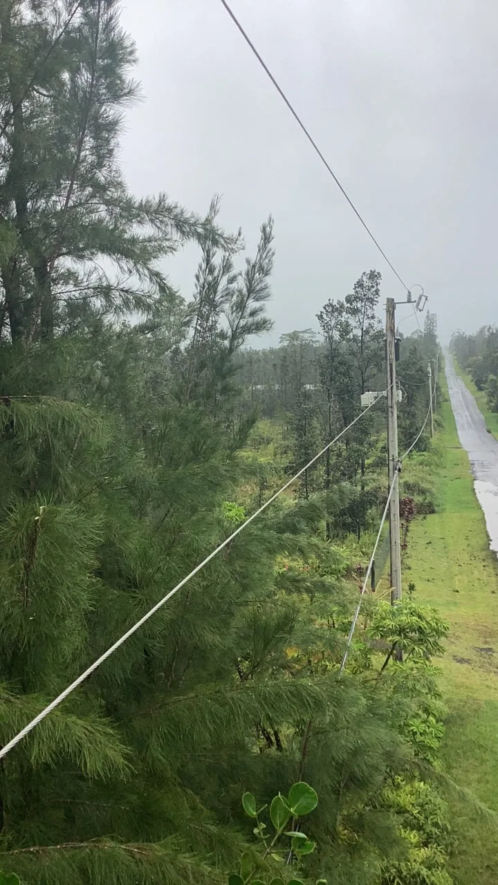
The storm, in the crews' own photos
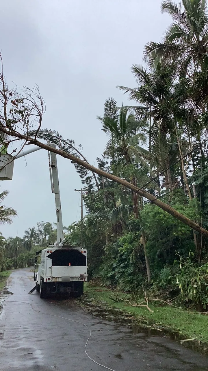
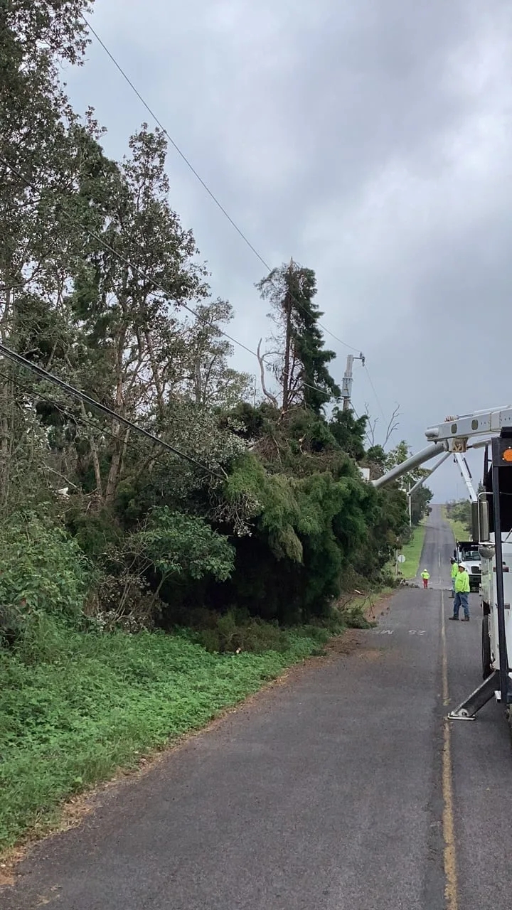
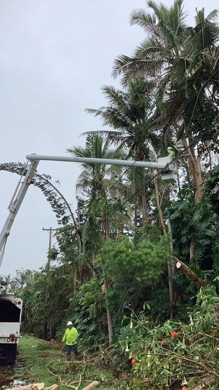
Five of the 958 field photos behind the report. Select one to see it at full size.
The problem
A storm turns a steady program into a rush. For two weeks the crews pruned and took down trees along the lines, logging each one in the field as they went. What came back was hundreds of records and nearly a thousand photos, and the totals would not agree: two program dashboards and the first draft of the storm report each gave a different count. Big Island Tree Service needed one set of numbers it could stand behind.
What we did
The crews logged the storm in the same Survey123 forms they fill in on their iPads every working day, so their records were already in the program's hosted data. Our part started there.
- We pulled every storm work record received from August 15 on, with the before and after photos attached to each, and checked all 958 photos against the originals one file at a time.
- We traced each gap between the dashboards and the draft down to the last digit, then fixed one basis for the whole report: the storm work category, records received from August 15, and a brush tally corrected for records that carried the wrong work date.
- We repaired two faults in the live dashboards that turned up along the way: a species chart that counted records instead of trees, and a date picker that quietly left out the final day of any range it was given.
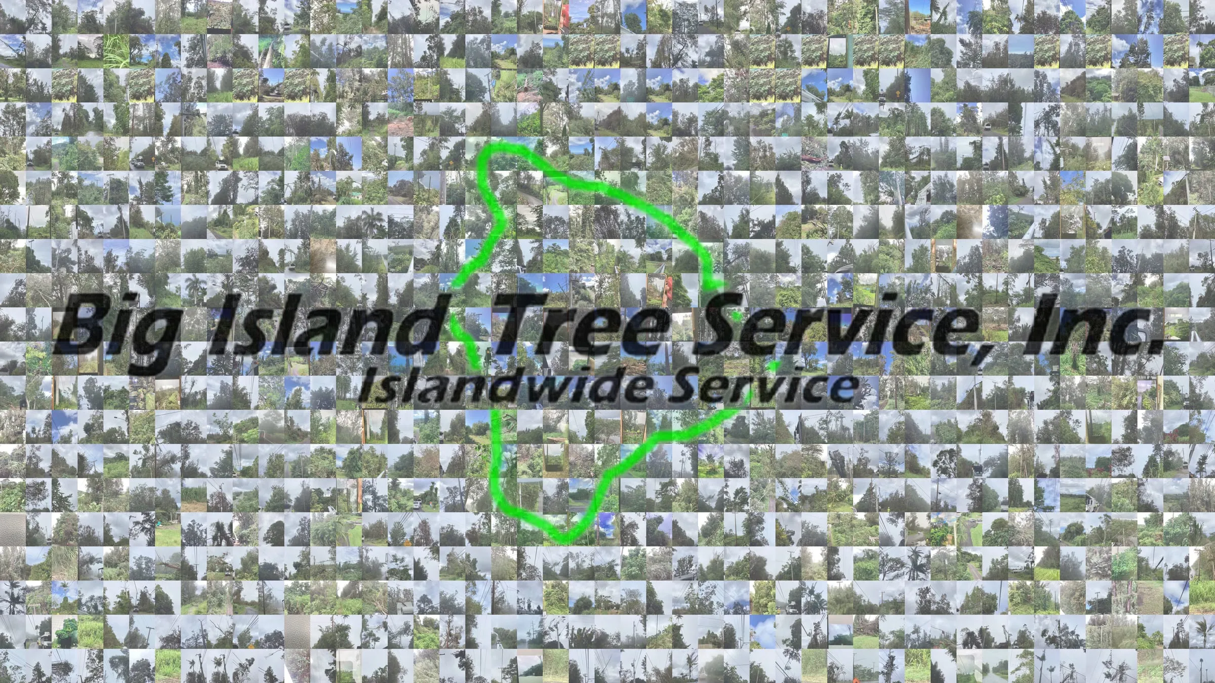
- We built the storm report: nine slides in the program's own dashboard colors and terms, a PDF at 600 DPI, and the Big Island Tree Service logo rebuilt as a mosaic from 934 of the crews' field photos.
The storm in the crews' photos
The crews photograph their work before and after; the photos at the top of this page come straight from those storm records.
What we delivered
- The storm report as a nine slide deck, a PDF, one image per slide and a lighter PDF for email
- The 958 before and after photos in one archive, with a manifest listing each
- A day by day timeline of the storm work as a spreadsheet
- The two dashboard repairs, live in the program
What it is used for
The report gives Big Island Tree Service one account of its Hurricane Lala work on Hawaiian Electric's system, on one stated basis: how many trees, how many spans and miles, which days, where on the island and how the crews got to each tree. Of the 1,860 trees, 1,656 were reached from the truck, 143 were worked from the ground and 61 were climbed. Ironwood took more work than any other species, with 459 trees.
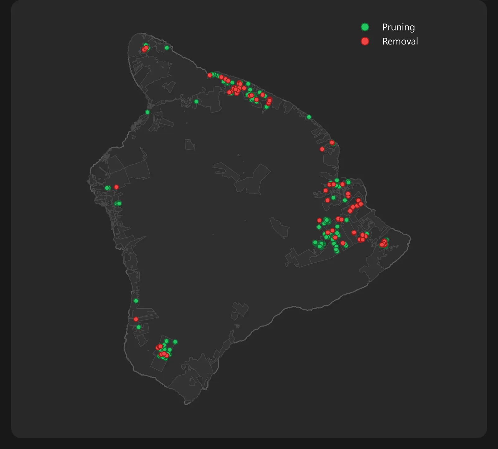
The report's map plots 596 storm work locations, from the northern tip of the island to the southwest.
The storm records ran through the same forms, hosted data and dashboards the crews use all year. See the vegetation management program →
The numbers
- trees worked in the storm
- 1,860
- trees pruned
- 1,412
- trees removed
- 448
- hazard trees
- 362
- square feet of brush
- 237,387
- miles worked
- 15.7
- spans worked
- 470
- circuits worked
- 36
- crews on storm work
- 9
- days of storm work in the 14 day window
- 13
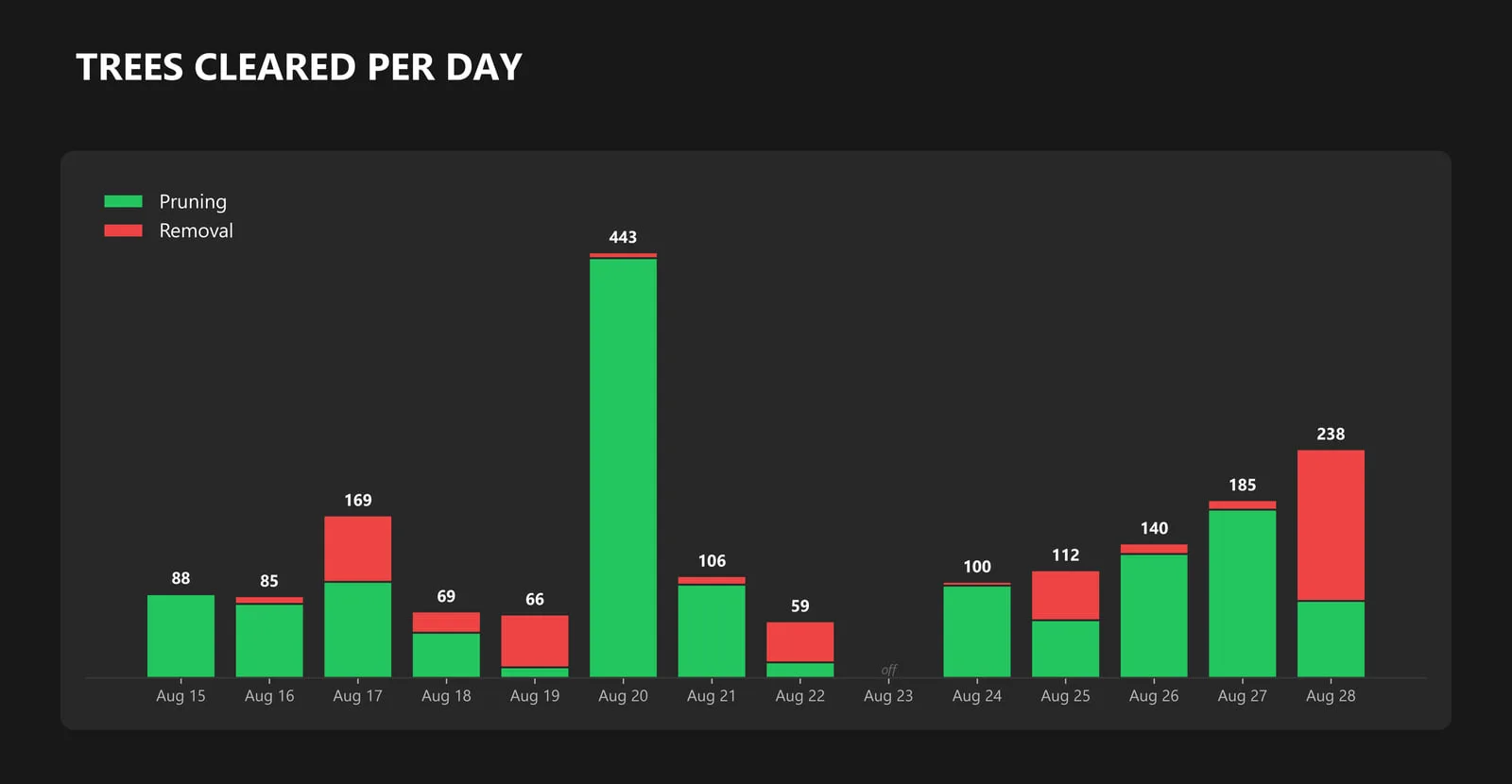
- trees on the biggest day, August 20
- 443
- before and after photos
- 958
Counted from the crews' storm work records received from August 15, 2026, with the brush tally corrected. The window ran from August 15 to 28, and storm work was logged on every day of it except August 23.
Related work and services
Running tree crews on utility lines?
Send the circuits or line miles, transmission or distribution, the clearance spec you work to and the date your report is due. We can set up the crews’ field forms, fly the corridors with drone LiDAR and build the report.