
Wildfire mitigation
Wildfire mitigation mapping, from wildland firefighters
Our wildfire mitigation mapping is on Hawaiʻi Island: drone LiDAR over power lines where the utility rates the fire risk highest, and a map of the fire mitigation work tree crews record. Mapping a fire once it is burning is a different job, done by the same firefighters, and it has its own page.
In pictures
Mitigation work on Hawaiʻi Island
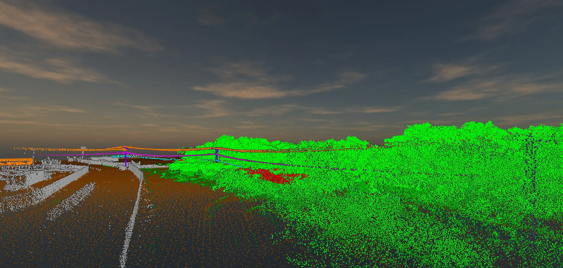
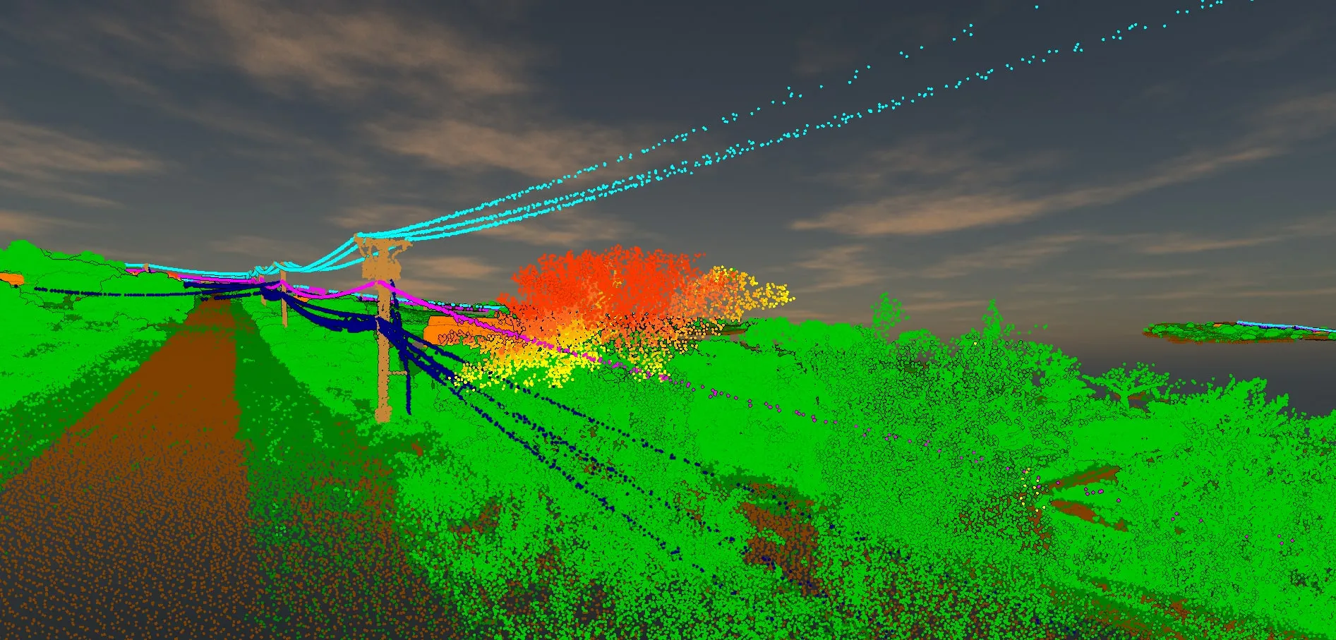
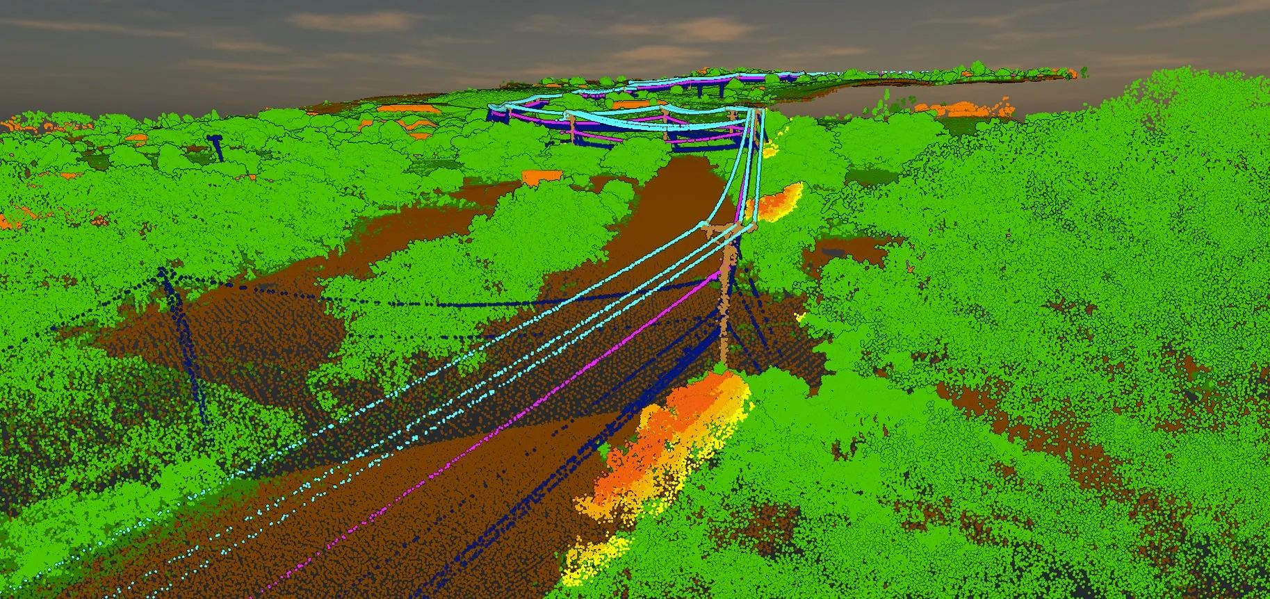
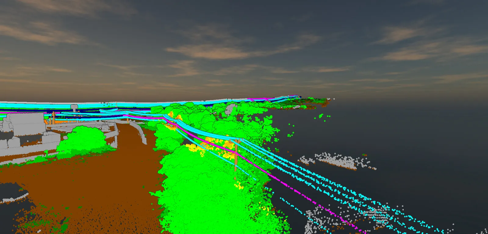
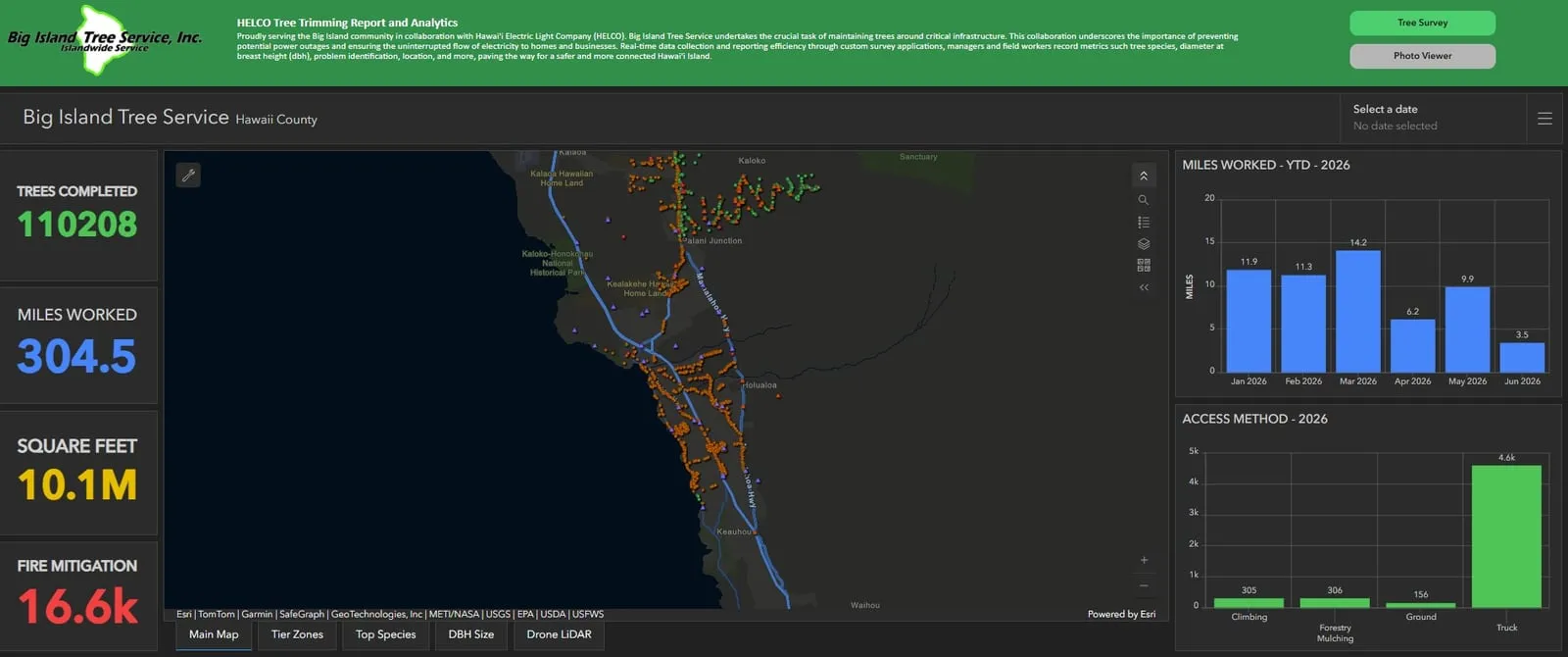
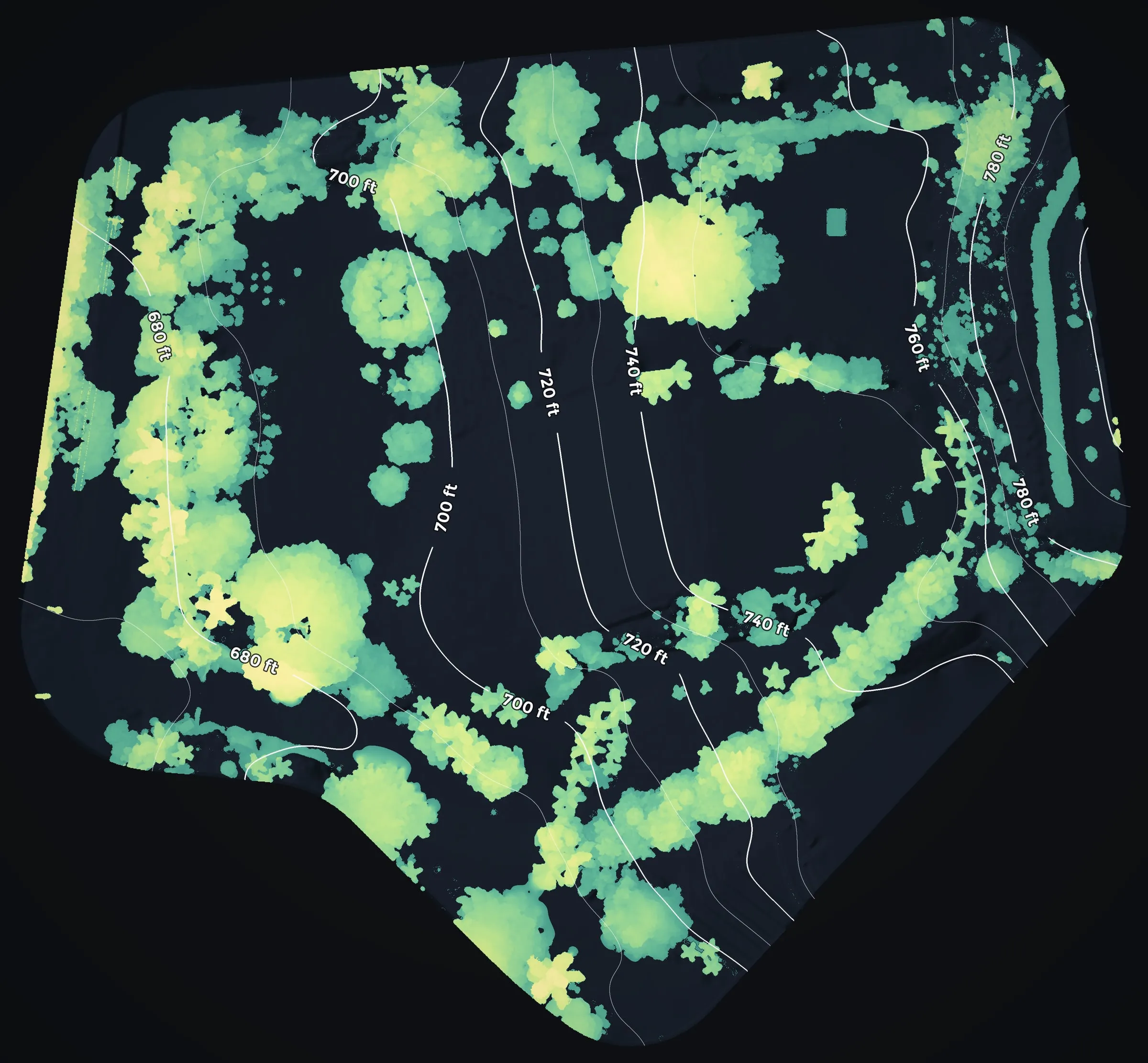
Trees reaching for the wires, the crews' fire tier records, and the canopy around a home.
Done here
Wildfire mitigation, in Hawaiʻi today
Our fire work in Hawaiʻi is mitigation: finding the trees and brush that have grown toward power lines, where they can start a fire, and keeping the record of the work that clears them. It is utility wildfire mitigation and vegetation management for Big Island Tree Service, the contractor that prunes and removes trees under Hawaiian Electric's lines island wide.
The work is led by our founder, Eli Polsky, who carries a wildland firefighter's red card with the FFT1, GISS and UASD qualifications behind it; his full record is on our About page.
Power line corridors in the highest fire risk tier
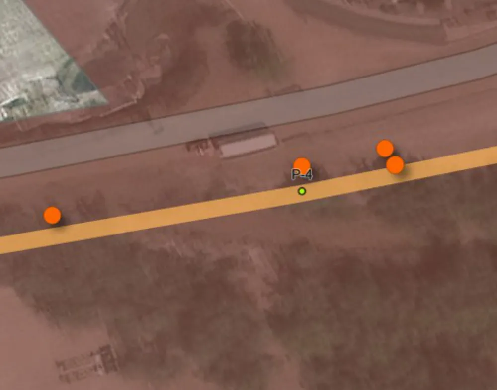
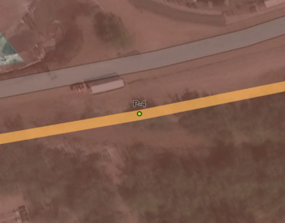
A drone LiDAR flight records a corridor in 3D: the ground, the poles and wires, and everything growing around them. We sort those returns into classes and flag the trees and brush by how close they have come to the lines, so vegetation managers can see which spans need a crew before the trucks roll. With repeat flights over the same stretches included, our count stands at 60+ miles flown.
Most of that corridor sits in Tier 3, the highest of Hawaiian Electric's three fire risk classes. In 2025 that was 13.25 of the 13.26 miles we flew; for 2026 it is 29.0 of the 47.5 planned miles. Near Kawaihae, the flags beside one pole in March 2025 were gone when the same stretch was flown again in April, after trimming.
- miles flown over power line corridors with drone LiDAR, repeat flights counted
- 60+
- Tier 3 miles in 2025, out of 13.26 corridor miles flown
- 13.25
- Tier 3 miles planned for 2026, out of 47.5
- 29.0
Fire mitigation in the tree crews' records
On the ground, Big Island Tree Service crews log each tree they work on iPads, in Survey123 forms we programmed and review every day. Wildfire mitigation is one of the kinds of work a crew can record, and the program's reports count the miles worked in each of the utility's fire risk tiers.
From January 5 to August 31, 2026, the crews logged 4,814 trees as fire mitigation, and 24.7 of the 104.3 miles they worked were in Tier 3.
- trees logged as fire mitigation, January 5 to August 31, 2026
- 4,814
- Tier 3 miles, out of 104.3 miles worked in the same period
- 24.7
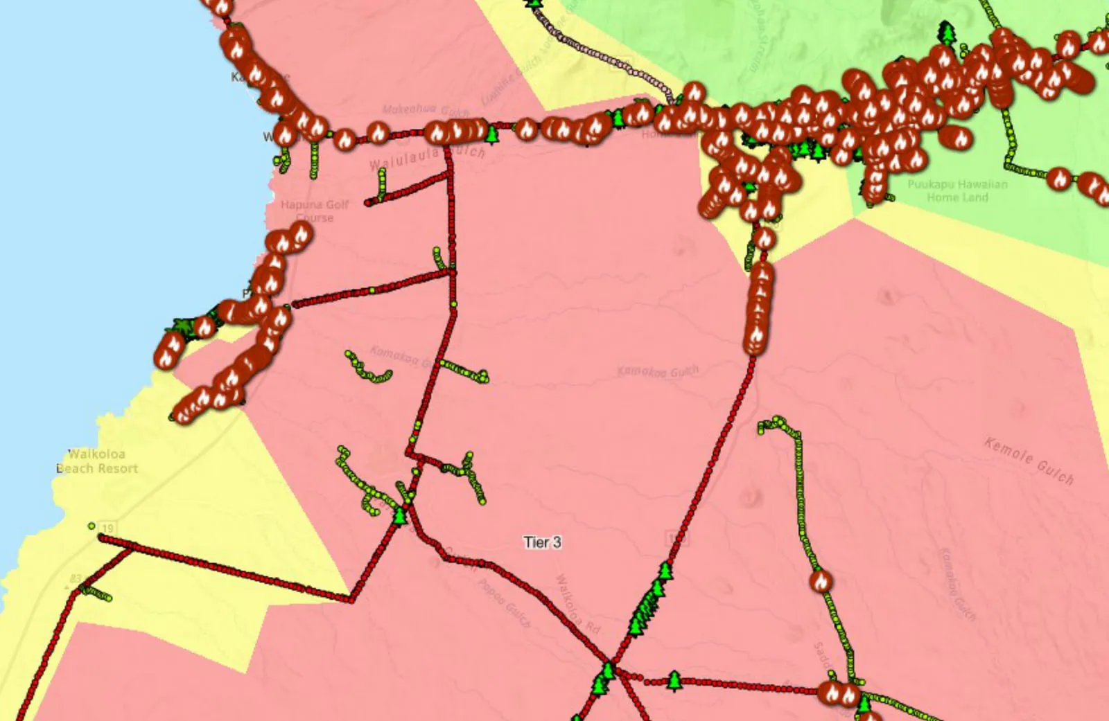
Tier 3 is the highest of the three fire risk classes on Hawaiian Electric's tier map. Corridor miles are measured along the lines in the areas flown. The crew figures are totals in the program's year to date workbook.
For landowners and agencies
Vegetation by height, near homes and roads
Landowners, counties and land agencies often start with a simpler question: what is growing near the homes, roads and lines that matter, and how tall is it? The drone LiDAR we fly over utility corridors answers that for a home site, a stretch of road or a whole property. It measures the height of the canopy and brush across the site, reaches the ground beneath them, and shows where tall growth stands close to a house, a driveway or a road edge.
On forested land in Volcano, one of our flights put 42 percent of the area flown under canopy taller than 6 ft.
Done in Oregon
Fuels mapping at the scale of a city plan
Our founder built this work on the mainland before Hawaii Mapping existed, and it is still running under our sister company, Rogue Reconnaissance. For the City of Ashland, Oregon it meant flying the whole town with drone LiDAR so a wildfire plan could say, block by block, where the fuel was.
About 4,300 acres went up in 100 acre pieces across 2024, at 250 feet. What came back was a classified point cloud and the products a planner can act on: ground and canopy models, a polygon for every tree crown, ladder fuel picked out of the vertical structure, and three exposure figures for each building in town. The 2025 Ashland Community Wildfire Protection Plan draws its fuels figures from it, names the company that flew it, and was accepted by the City Council on August 19, 2025.
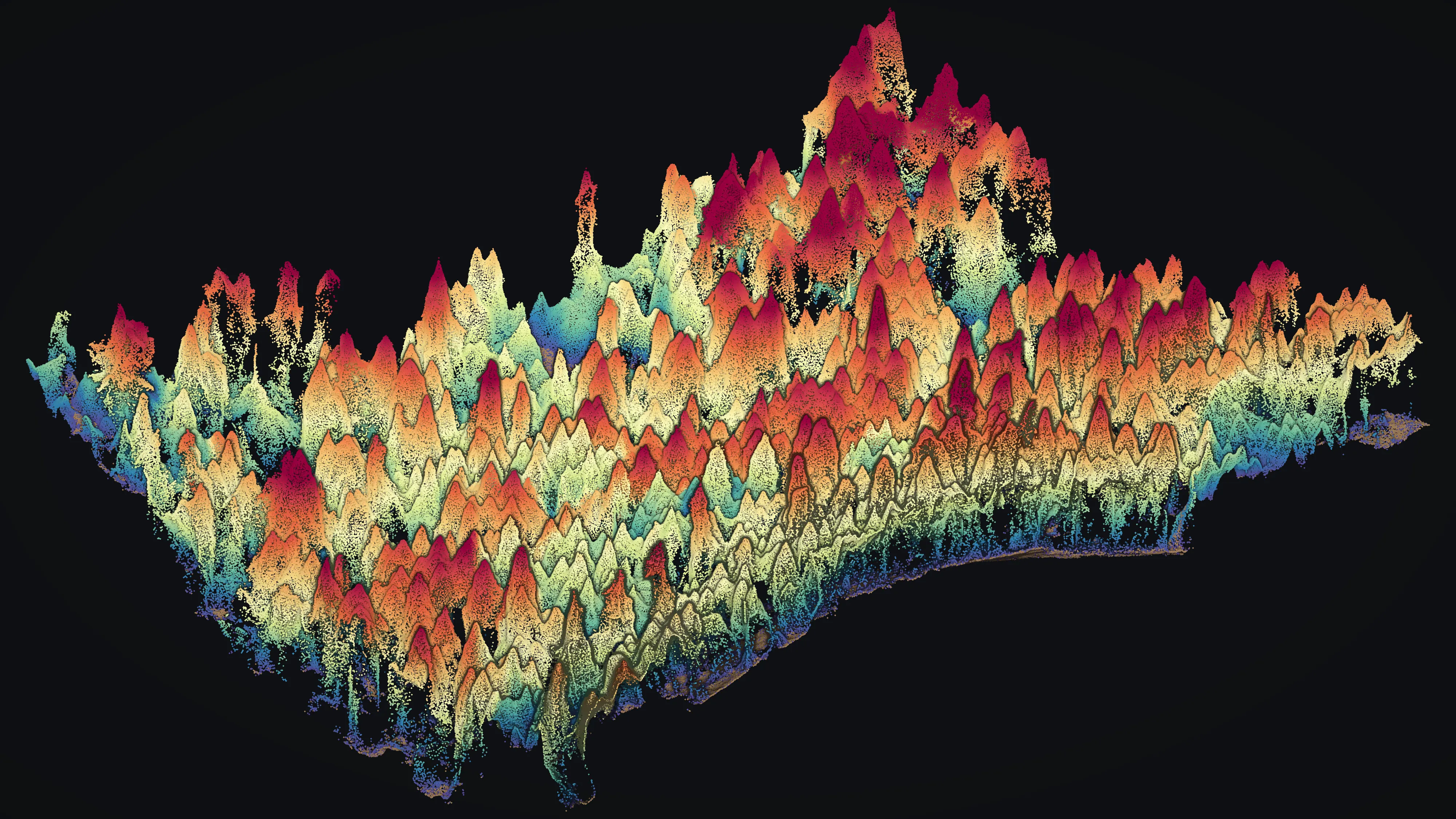
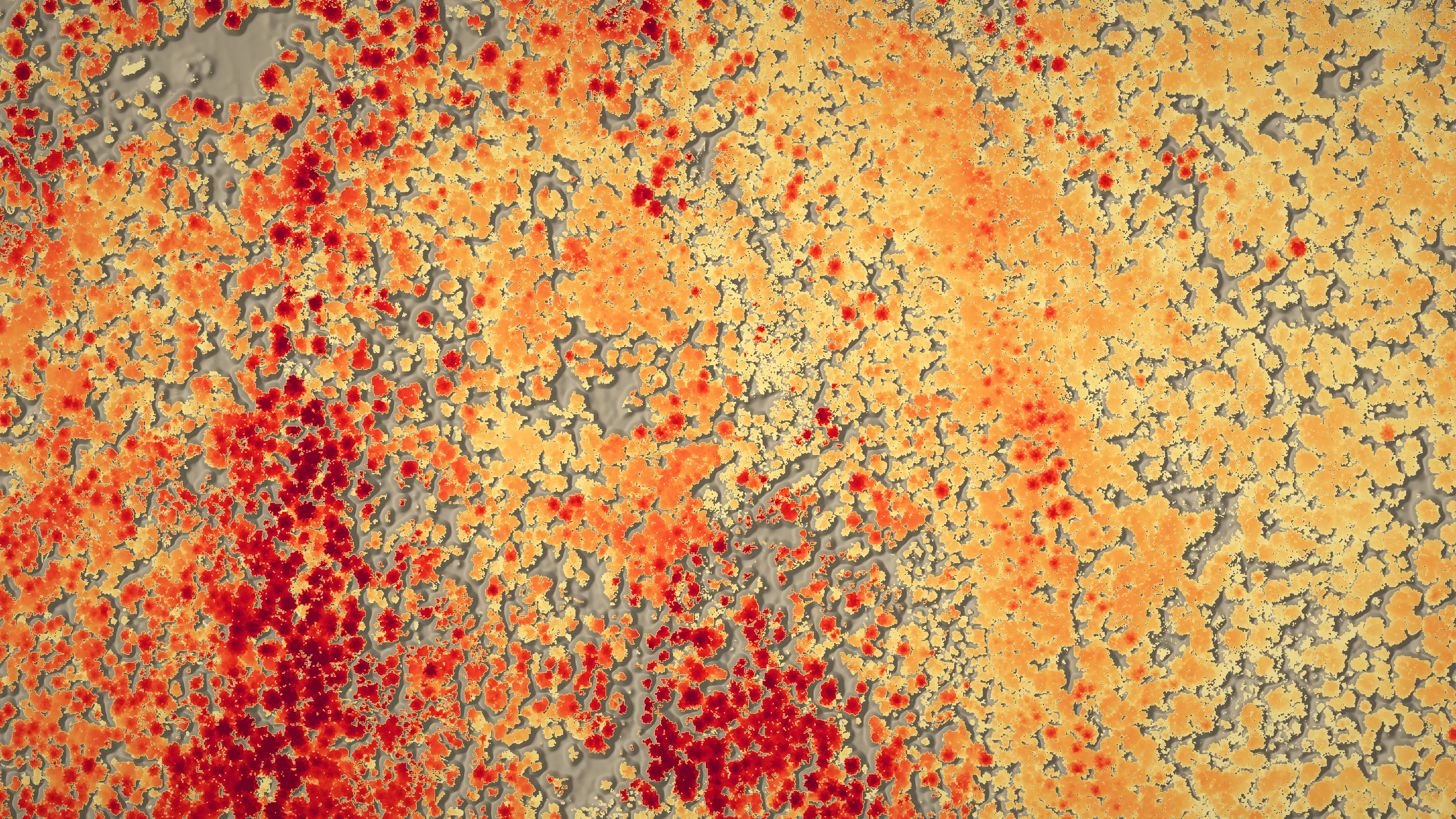
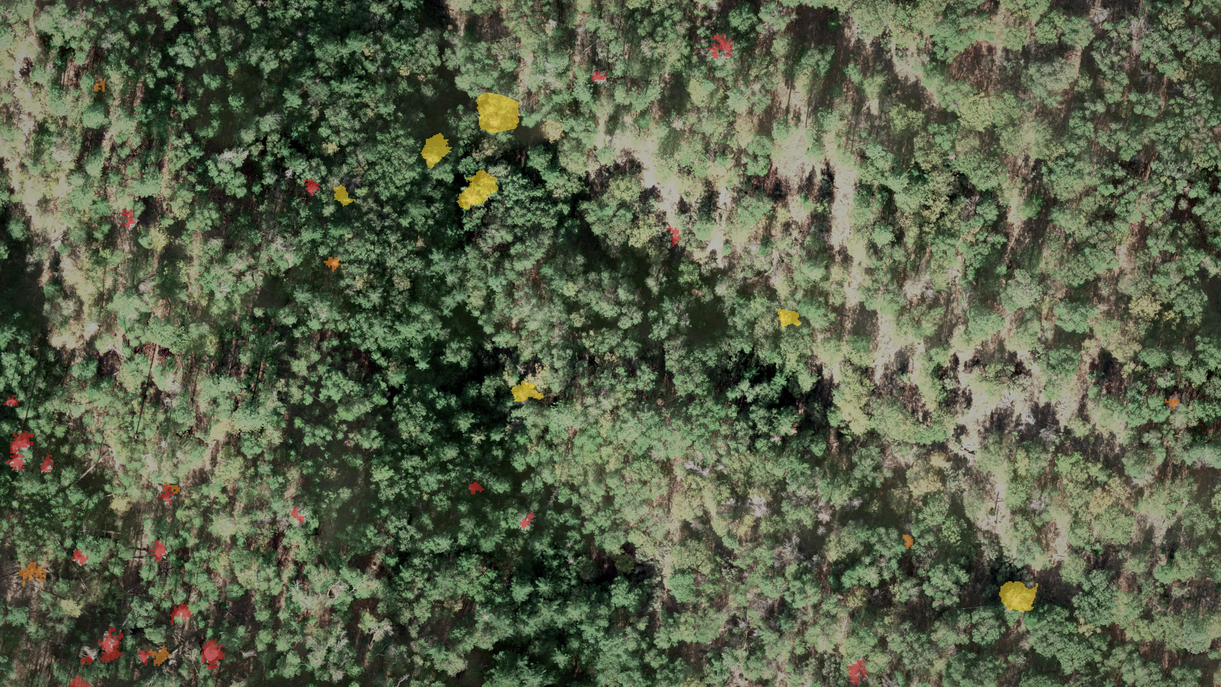
Oregon work, flown and delivered by Rogue Reconnaissance, our sister company. We are bringing the same methods to Hawaiʻi Island. How the fuels mapping is done
The other half
Mapping the fire itself
Mitigation is the work that keeps a fire from starting. When one has started, the job changes: a night infrared flight, the heat found and mapped, a perimeter, and data the incident's GIS specialist can load.
That is a page of its own. It has what an incident team gets from a flight, the national wildland fire qualifications behind it, and the maps our founder has delivered to fires in Oregon with our sister company Rogue Reconnaissance.
Where to start
Utilities, tree crews and landowners
A utility or a tree crew: send the circuits or miles of line, whether they are transmission or distribution, your clearance spec and when you report. A landowner: the island, where the land is and about how many acres. We will come back with a plan for the flight and the data it would give you.
Request a QuoteIncident teams, counties and agencies
Our fire mapping drone is kept ready in Kona, on Hawaiʻi Island. If you plan for fires in Hawaiʻi, fight them or map them, start on the fire mapping page: what a night flight produces, who flies it, and the maps behind it.
Wildland fire mapping