

Case study · trails and forest
Koaiʻa: 372 acres of drone LiDAR for trail planning
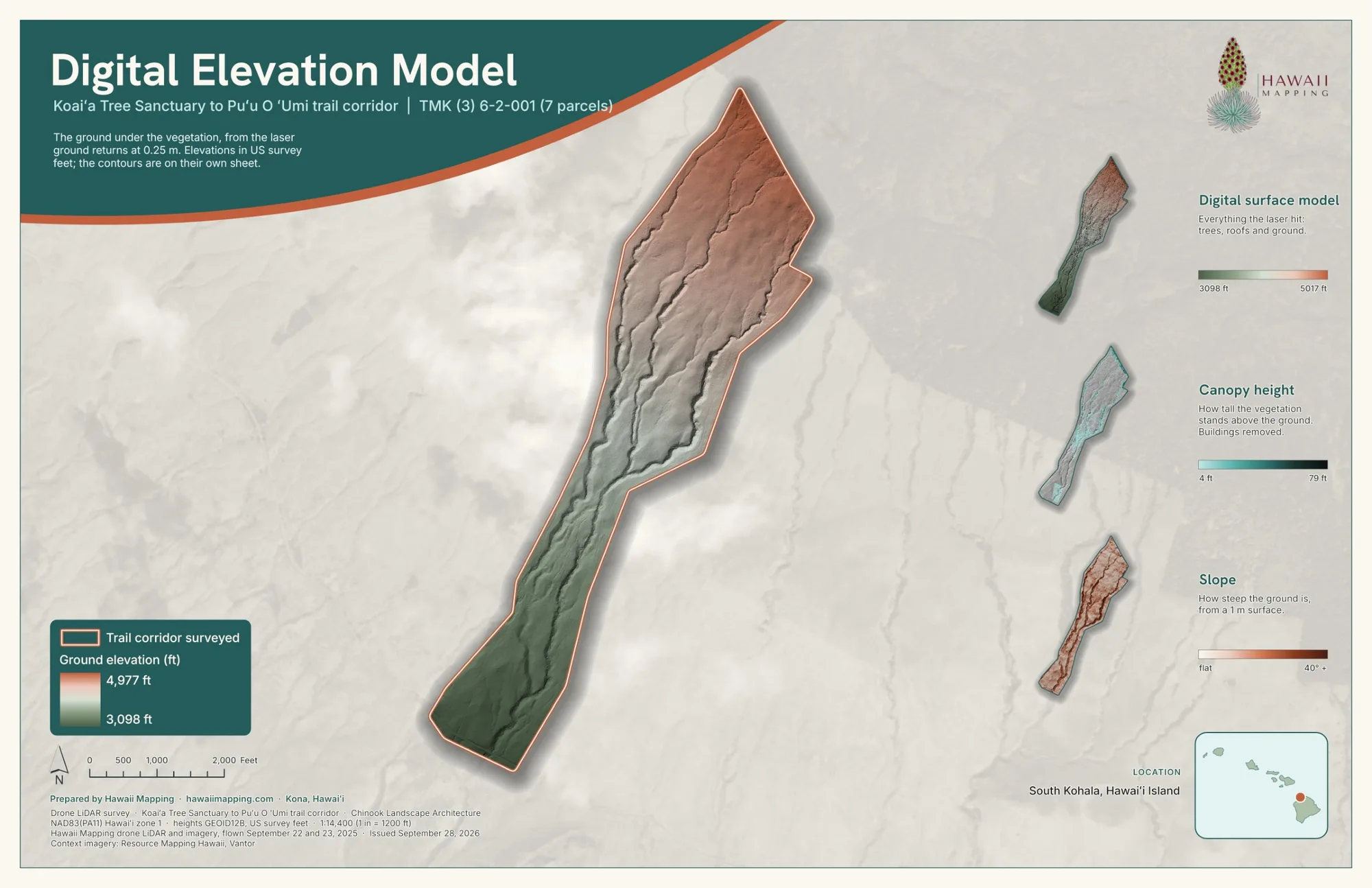
Chinook Landscape Architecture brought us in to fly drone LiDAR over 372 acres above the Koaiʻa Tree Sanctuary, on the Kohala slopes northwest of Waimea. Our bare earth and canopy data went into the plan for the new trails, and the datasets were passed on to DLNR.
The corridor, in our maps and data
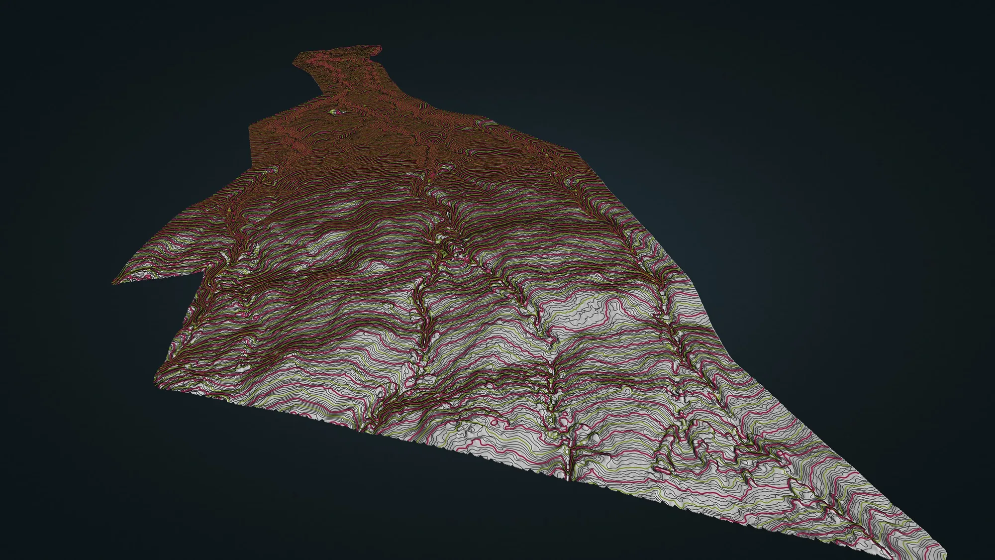
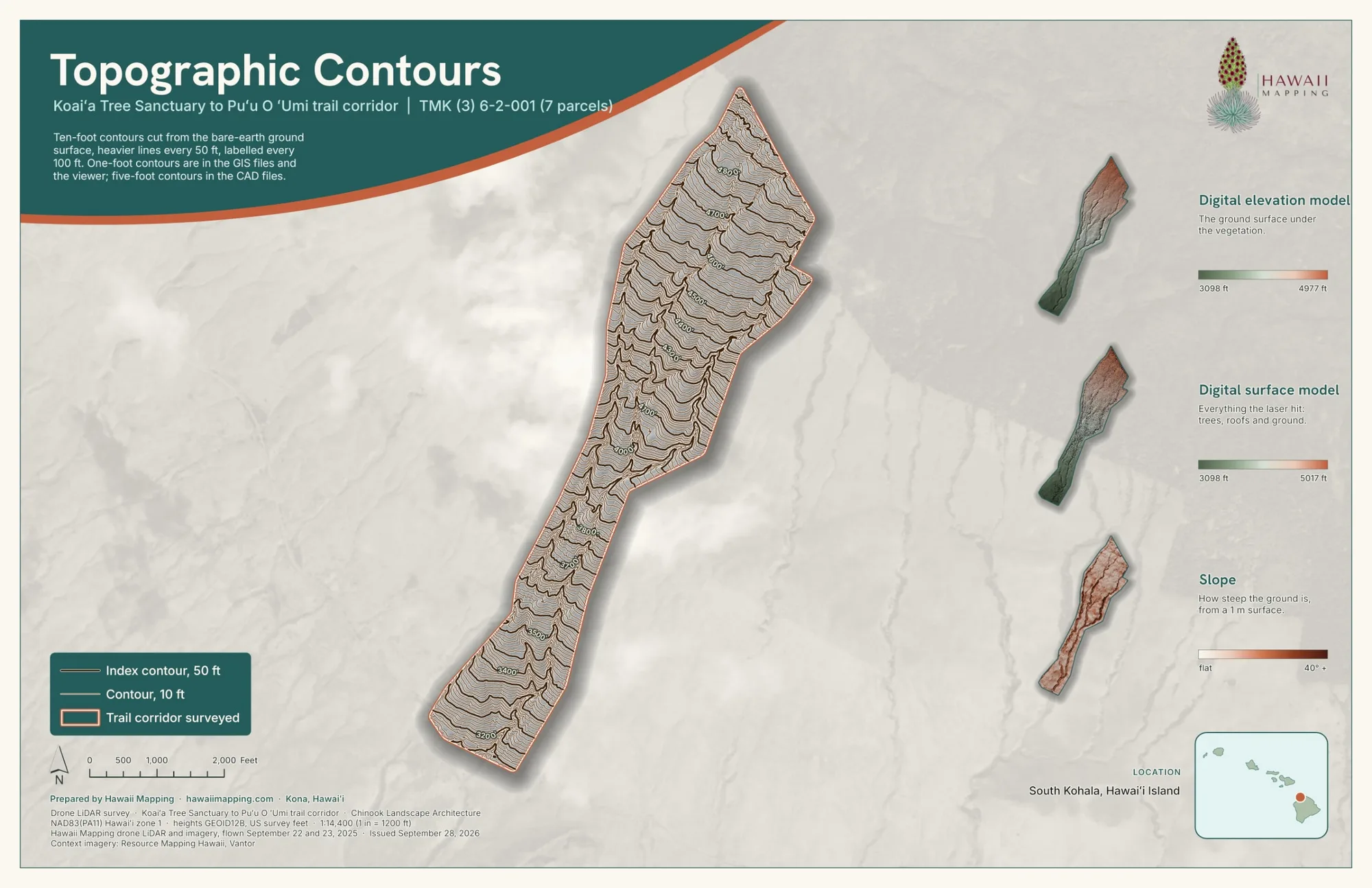
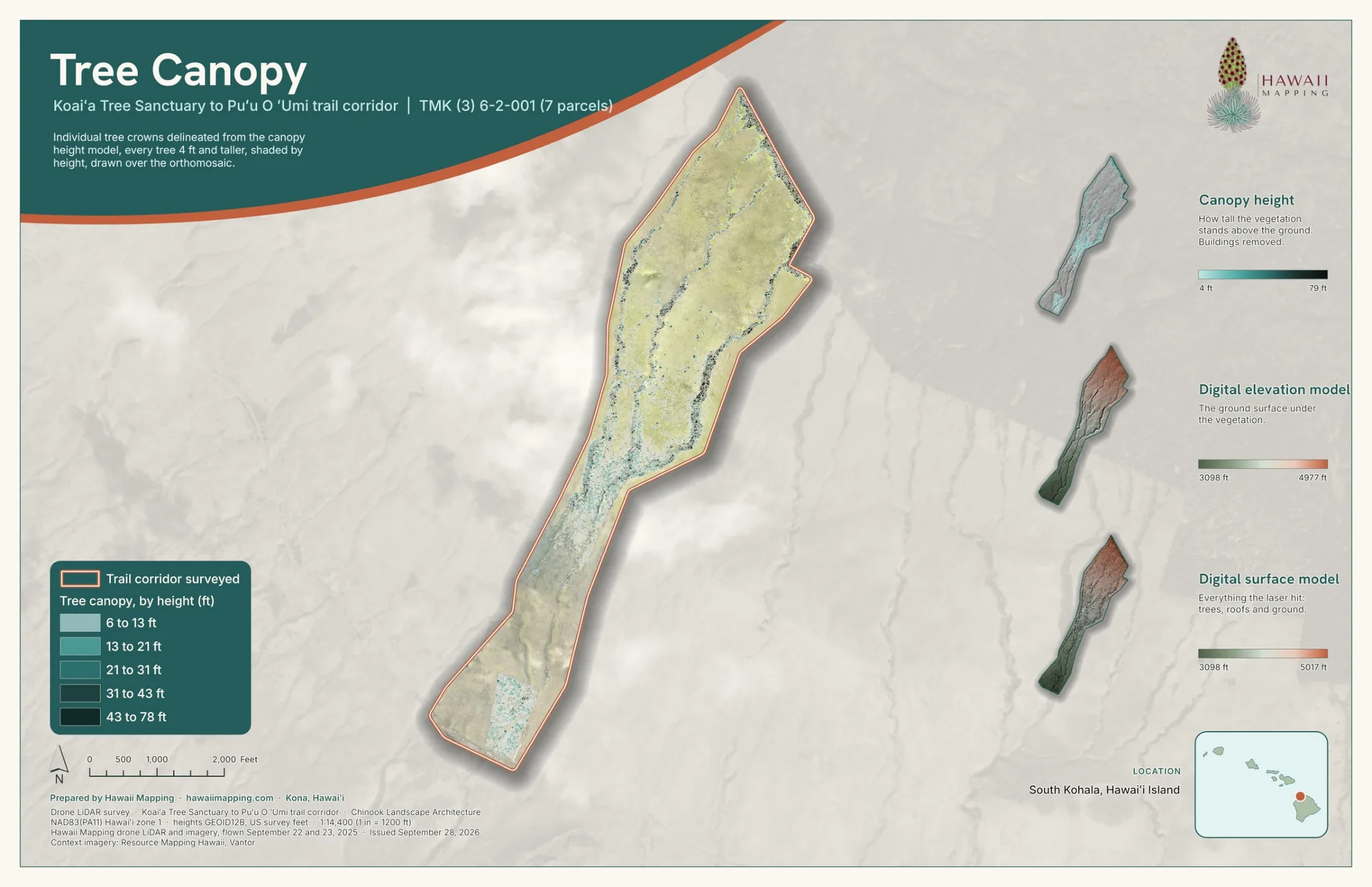
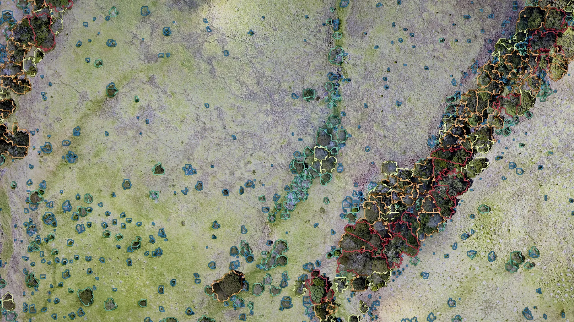
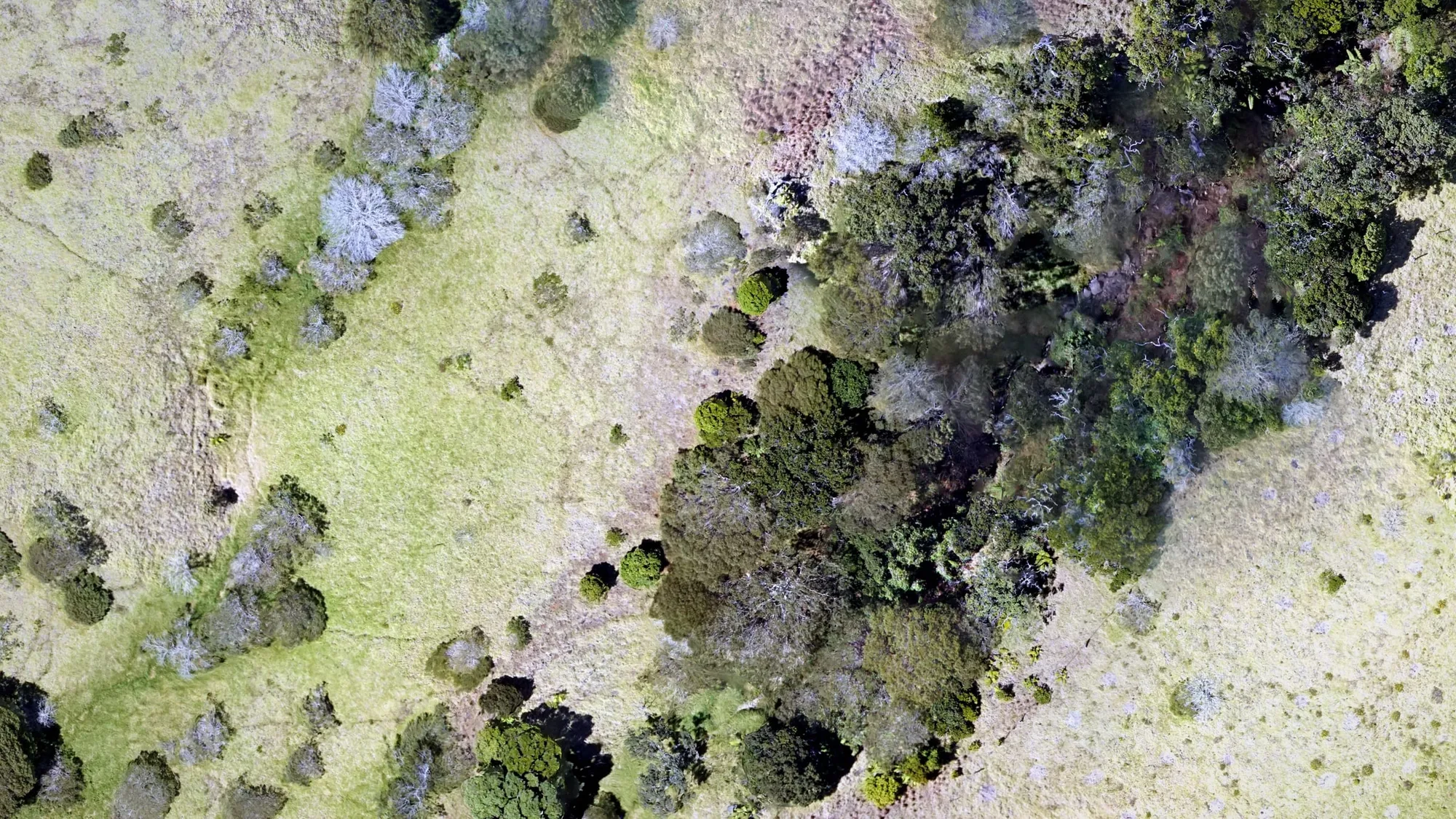
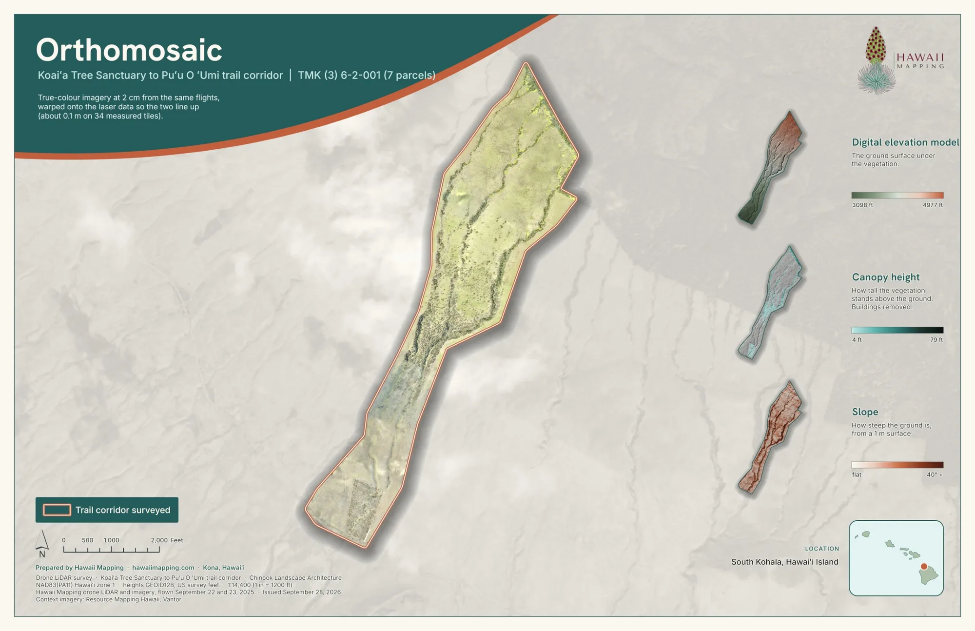
Map sheets, the online viewer and the LiDAR itself. Tap any picture to see it large.


The problem
The planning team had been asked for new shared use trails, for hikers and bikers, climbing from the Koaiʻa Tree Sanctuary up State land toward the edge of the Puʻu O ʻUmi Natural Area Reserve. The State's forestry staff have spent decades replanting that land. Putting a trail on it lightly takes two things an ordinary topographic map cannot give: the real shape of the ground beneath the trees, and a record of the trees themselves.
What we flew
We flew the corridor with drone LiDAR and a camera on September 22 and 23, 2025, in four sections, with a GNSS base station logging on site, covering the whole 372 acre area of interest.
What we delivered
- The point cloud, 760,978,949 points, with a web viewer
- A bare earth model on a 1 ft grid
- 18,620 contour lines at a 1 ft interval
- Canopy height models, and an orthomosaic with pixels about 2 cm across
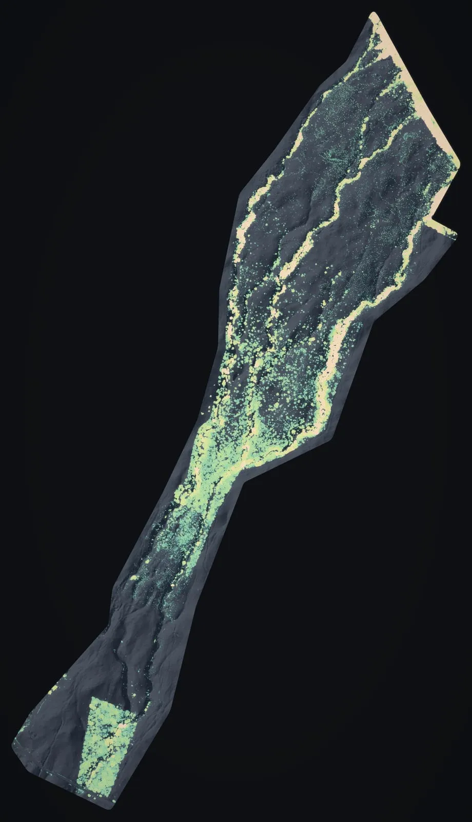
- 34,336 tree crowns drawn as polygons with their heights, and 34,513 treetops
Every delivered file came in NAD83(PA11) State Plane coordinates for Hawaiʻi zone 1, in feet.
What it was used for
The December 2025 trail report from the planning team, which includes Chinook Landscape Architecture, prints our canopy height and bare earth data beneath its proposed routes. It lays out a main trail running about 3.7 miles one way, planned as an out and back and flagged on the ground, and about 3.4 miles of further trails designed at a conceptual level from the drone LiDAR and photo data. The report also records that the datasets were handed to DLNR's Nā Ala Hele trail program and its Division of Forestry and Wildlife for their own use, and it sees work for the data beyond the trails, in forest health management and in assessing and managing natural areas.
The numbers
- acres flown
- 372
- points in the delivered cloud
- 760,978,949
- tree crowns mapped
- 34,336
- contour lines at 1 ft
- 18,620
- miles one way on the planned out and back main trail
- 3.7
- miles of conceptual trails drawn on our data
- 3.4
Counts from the delivered files. Each crown carries its height and outline, not its species. The trail miles are the planning team's, from its December 2025 report.
2026: the package rebuilt and checked
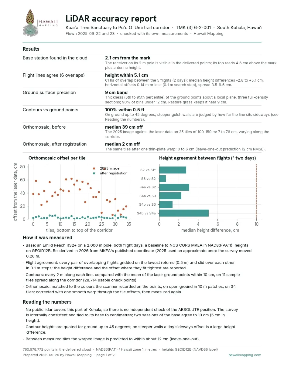
In September 2026 we went back to the Koaiʻa data and rebuilt the package to the standard every job now gets. The data was tied again to the published position of the continuous GNSS reference station on Mauna Kea, which moved it 0.26 m. The 2025 orthomosaic was found to sit a median 39 cm off the laser data, by different amounts along the corridor, so it was warped onto the point cloud through 34 measured tiles; it now sits a median 2 cm off. The whole corridor also opens in our online viewer, and six map sheets and an accuracy report came with it.
- The base station's tripod shows up in the point cloud 2.1 cm from its mark
- The five flights, over two days, agree in height to within 5.1 cm where they overlap
- The ground points form a band about 9 cm thick, mostly pasture grass
- Every checked contour sits within 0.5 ft of the laser ground points on ground up to 45 degrees
No public lidar covers this part of Kohala, so these numbers show the data agrees with itself and its base station; they are not a check against an independent source.
Related work and services
Planning trails or restoration on forested land?
Send the area and its acreage, what the plan has to show and who will receive the data. We work with planners, landowners and the programs that look after public land.